Wreck #16, Dorcas Pendell (1884-1914)
Schooner, 148x31 ft., 2 masts
Coordinates (approximate location):
- 43.837556°, -082.637439°
- 43° 50.25336', -082° 38.24634'
- 43° 50' 15.2016", -082° 38' 14.7804"
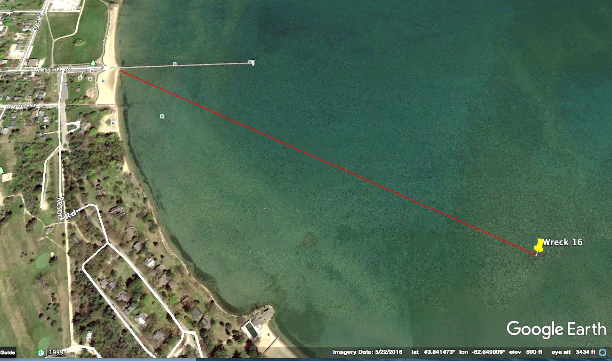
Wreck is 2,900 ft. from shore on a bearing of 118 degrees. Public parking near the Trescott St. pier.

Check Maritime Database for vessel details. Location is south side of Harbor Beach.

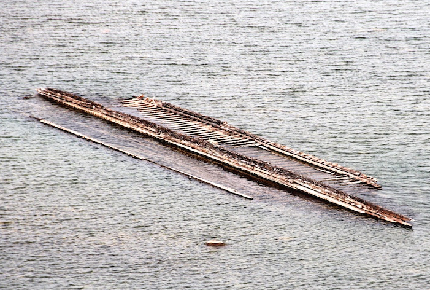
The exposed (at low water) wreck of the schooner Dorcas Pendell (1884) is located at Harbor Beach near, the south end of the refuge harbor off the point at Resort Road. Water depth is about 6 ft.
Michigan's historic shipwrecks are protected by law. Please do not disturb any remains.