Wreck #8, Marquis aka Tobias Butler (1872-1892)
Schooner-Barge, 148x29 ft., 3 masts
Coordinates (approximate location):
- 43.911960° , -82.679624°
- 43° 54.71760', -082° 40.77744'
- 43° 54' 43.0560", -082° 40' 46.6464"
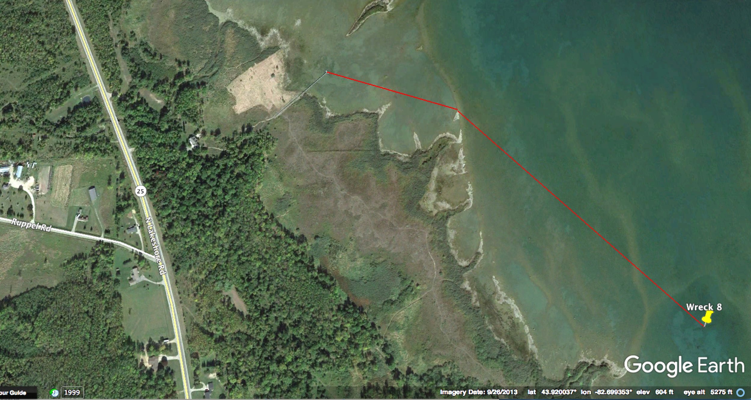
Wreck is 1,300 ft. from shore on bearings of 107 and 134 degrees. Shore access may be only through private driveways or trails from M-25. Please respect private property.

Identity of wreck in the Maritime Database is uncertain. Location is about 2 miles south of Port Hope.
Michigan's historic shipwrecks are protected by law. Please do not disturb any remains.